The Route of the Volcanoes (Ruta de los Volcanes), part of the GR-131 or “El Bastón” (“The Staff”), is one of the most spectacular hikes in La Palma.
It follows the volcanic ridge of Cumbre Vieja, crossing historic cones and dramatic volcanic landscapes from El Refugio del Pilar to the Fuencaliente Lighthouse.
Highlights of the Route
- Journey among volcanoes:
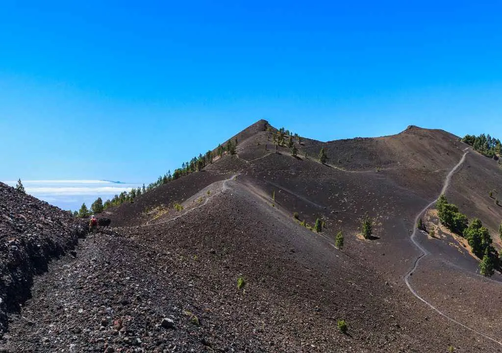
The trail passes legendary cones: Birigoyo, Hoyo Negro (eruption 1949), Duraznero, Las Deseadas (1,945 m), San Antonio (1677), and the historic Teneguía (1971). - Breathtaking views:
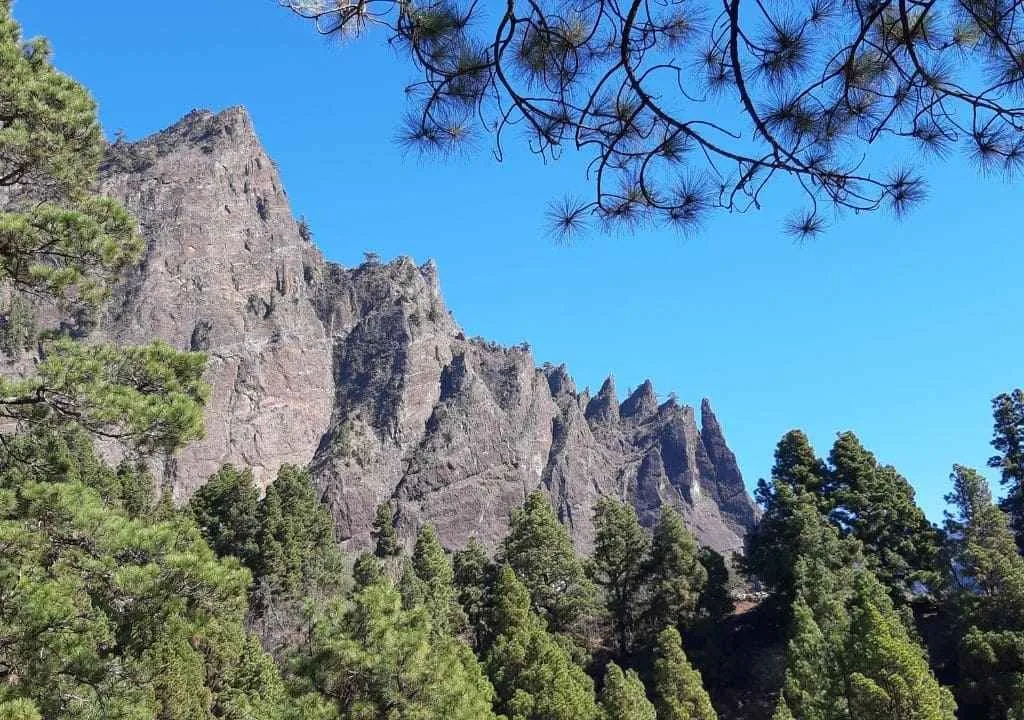
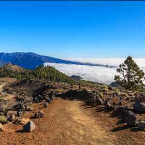
Expect stunning panoramas above the clouds : the Caldera de Taburiente, Aridane Valley, the coast, and even other islands like Tenerife, La Gomera, and El Hierro. - Diverse landscapes:
You’ll walk through pine forests at the start, pure volcanic terrain along the ridge, and lush Canarian pine and shrubs near the end. - Sporting challenge:
A demanding 23–25 km trail with over 2,200 m of descent, testing your endurance, strength, and spirit.
Technical Information – Route of the Volcanoes
| Parameter | Details |
|---|---|
| Distance | 17.5 km to 25 km (depending on the chosen section) |
| Elevation change | +500–670 m / −1,200–2,100 m depending on the route |
| Maximum altitude | 1,945–1,977 m (Las Deseadas) |
| Duration | 6–8 h without stops; up to 9 h with breaks and photos |
| Difficulty | High (length, elevation, sun exposure); moderate technical level |
| Route type | Linear, from north (El Refugio del Pilar) to south (Fuencaliente Lighthouse) |
What to See Along the Way
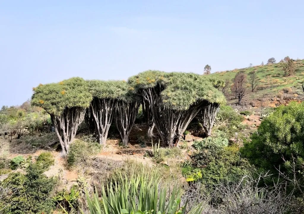
The adventure begins at 1,440 m above sea level at El Refugio del Pilar, climbing gently southward through pine forests and volcanic ridges, home to endemic species like the red-billed chough and kestrel.
Connect with nature on this journey through volcanoes and pines, and enjoy unique highlights such as:
- Birigoyo viewpoint: first sweeping views of La Caldera de Taburiente and Roque de los Muchachos.
- Hoyo Negro cone: epicentre of the San Juan eruption in 1949, with its black lava flows still intact.
- Duraznero Volcano: remains of lava lakes and flows descending eastward.
- San Martín Volcano: striking for its deep red tones and pointed cone, one of the most photogenic spots on the trail.
Explore the Route of the Volcanoes with guide
Volcanic Majesty Awaits: Discover La Palma’s Stunning Volcano Route on a Guided Group Tour.
- Las Deseadas: the highest point of the route, perfect for panoramic photos.
- San Antonio Volcano and Visitor Centre: optional visit to learn more about La Palma’s volcanic history.
- Fuencaliente Lighthouse and Teneguía Volcano: the grand finale, sea views, salt pans, and unforgettable sunsets.
Practical Tips for the Hike
Plan your transport in advance:
There are no direct public buses to the starting point (El Refugio del Pilar). You have three main options:
- Bus + taxi combination:
Take a bus to El Paso and a taxi to the trailhead, the most economical choice for solo travellers or small groups.
At the end, you can return by bus from Los Canarios or Fuencaliente Lighthouse. - Direct taxi from your accommodation:
Ideal if you’re staying far away or want extra comfort. - Guided excursion (recommended):
Includes guide, round-trip transport, insurance, and explanations during the hike, best value for a full experience.
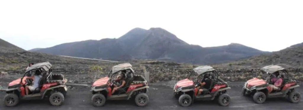
Explore the marvelous Route of the Volcanoes with adrenaline and adventure!
Thrilling Buggy Adventure: Join Our Guided Group Tour Along La Palma’s Volcano Route.
YOUR EXPERIENCE SHINES HERE
If you’ve visited this place, share your impressions and leave a small trace of your journey. Help other travelers discover the true beauty of La Palma.
*Your review is completely anonymous
Local Tips
- Start early:
Begin early in the morning to avoid heat and allow time to enjoy the views. - Wear proper footwear:
Trail or hiking shoes with strong grip are essential for volcanic and loose terrain. - Sun protection:
Hat, sunglasses, sunscreen, and at least 3 litres of water. - Layered clothing:
Light jacket for higher altitudes and a windbreaker, mornings can be cool. - Bring energy food:
Energy bars, nuts, and fruit that resist heat. - Avoid winter with bad weather:
Wind, fog, or rain reduce visibility and make the ridge uncomfortable. - Check the weather:
Avoid hiking if heavy rain, strong winds, or heat alerts are forecast. - Stay on the marked trail.
- Carry GPS or offline maps:
The trail is well marked, but a backup on your phone is always useful.

Volcano Route Map