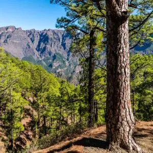
Walking through the Caldera de Taburiente is an experience that awakens every sense.
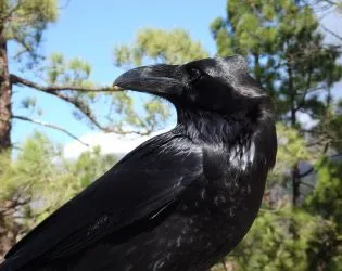
From the very beginning, the air is filled with the rich scent of Canary pine, a fragrance that follows you with every step, while the echoing call of the choughs resonates from the peaks above.
The trail, mostly downhill, lets you move effortlessly through this natural wonder, breathing in the pure, refreshing air that feels like it’s cleansing your lungs.
As you approach the river, the humidity rises and a cool, gentle breeze runs along the ravine. In spring or winter, the path is perfumed by the native flowers that bloom across the highlands, blending into a fragrance that can only be felt here, in the green heart of La Palma.
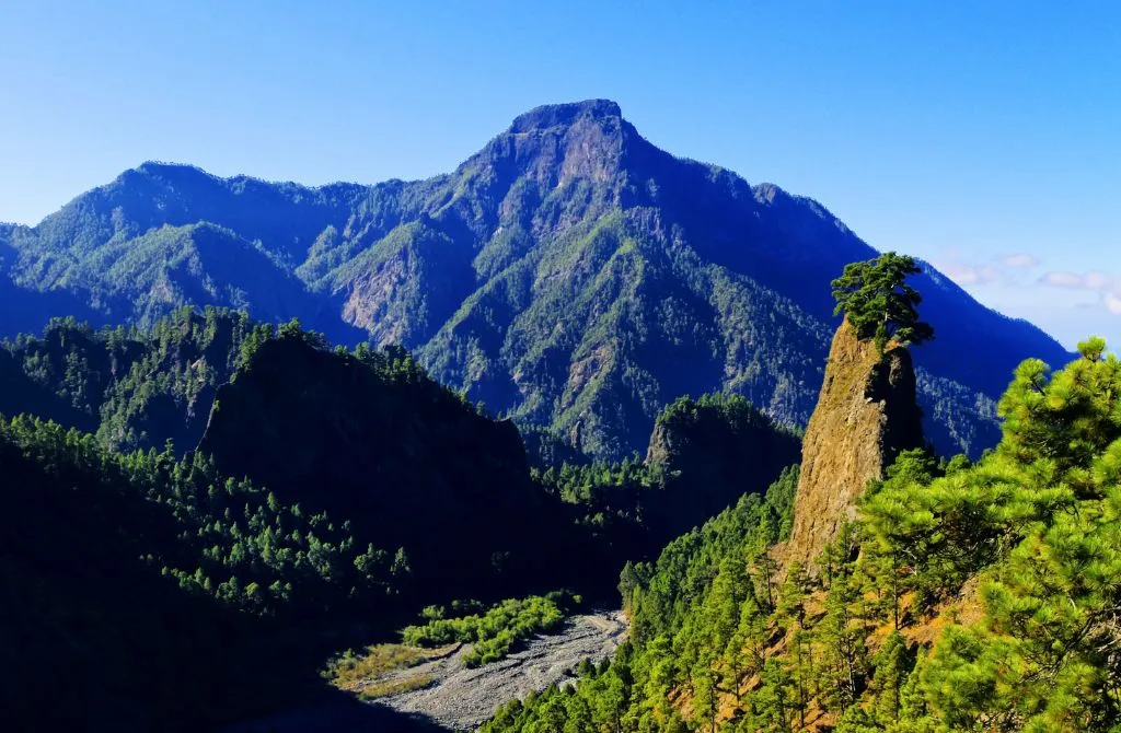
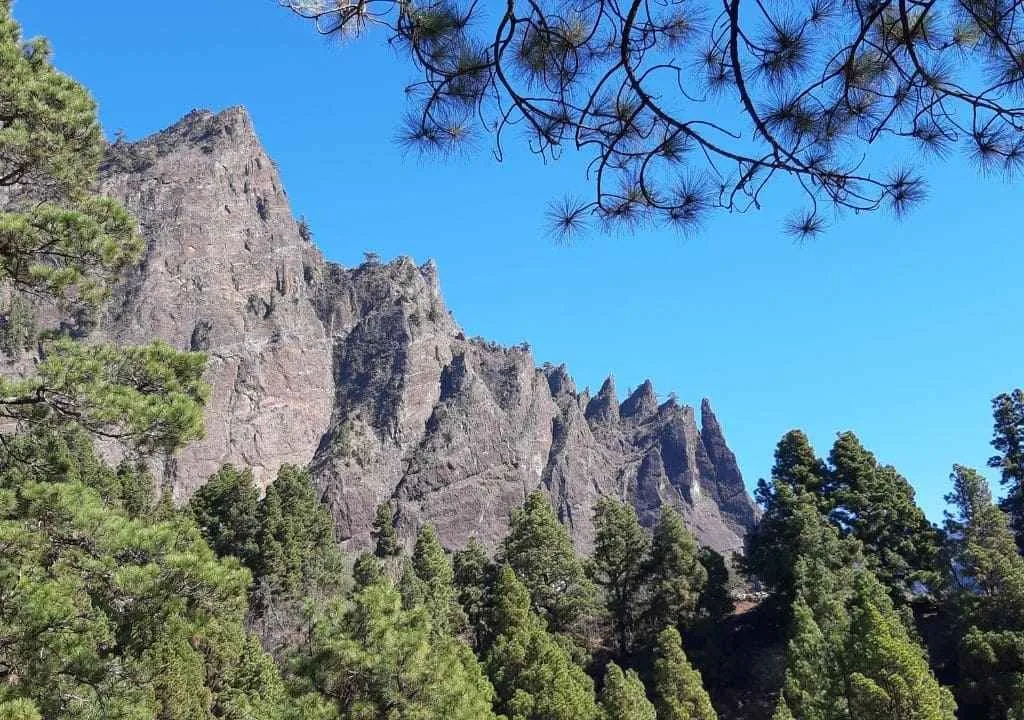
The Caldera de Taburiente National Park is one of the most spectacular natural spaces in the Canary Islands. Declared a National Park in 1954, this volcanic and forested basin stands out for its geological, ecological, and scenic wealth.
In this guide, you’ll find everything you need to explore it, from its most famous trails to practical tips to make the most of your visit.
Technical Data of the Park
| Key Information | Details |
|---|---|
| Surface area | 46.9 km² + 12.6 km² (buffer zone) |
| Altitude | 600–900 m (bottom), up to 2,426 m |
| Approx. diameter | 8 km |
| Declared National Park | 1954 |
| Main ecosystems | Canary pine forest, laurel forest (monteverde), ravines, watercourses |
| Climate | Humid oceanic climate at the base, dry at higher elevations |
What to See and Do in the Caldera de Taburiente National Park
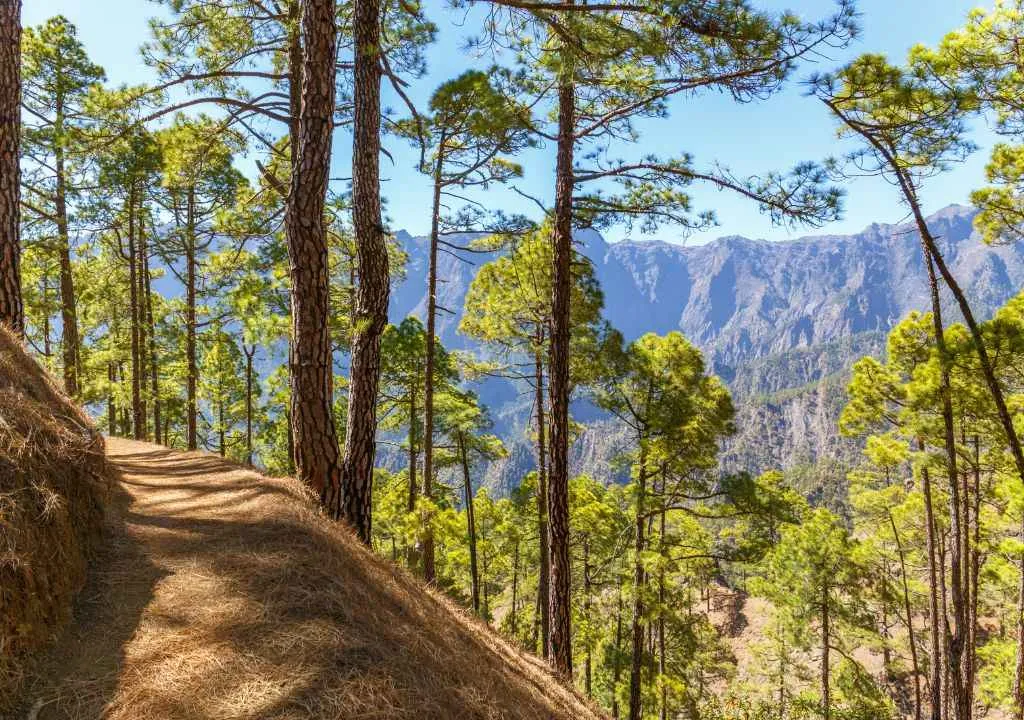
To truly explore the Caldera de Taburiente National Park, lace up your hiking boots and set out among the towering Canary pines, crystal-clear streams, and dramatic volcanic formations.
You can start your visit at the modern Visitor Centre in El Paso or enjoy the breathtaking views from La Cumbrecita viewpoint, one of the most spectacular natural windows into the heart of the caldera.
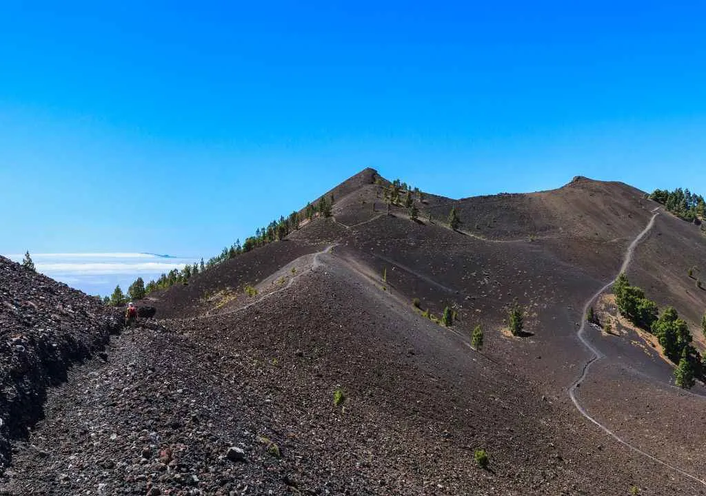
The main hiking route (moderate difficulty) begins at Los Brecitos and leads deep into the National Park, descending through the Playa de Taburiente area before continuing towards the Barranco de las Angustias.
Along the way, take time to:
- Breathe in the scent of ancient pines. The fragrance of these centuries-old trees fills the air and evokes a deep sense of calm.
- Admire the view of Roque Idafe. This striking basalt monolith held great spiritual value for the island’s ancient inhabitants, the Benahoarites.
- Enjoy the panoramic views. From several points inside the caldera, the landscapes open wide to reveal volcanic ridges, forests, and clouds rolling over the rim.
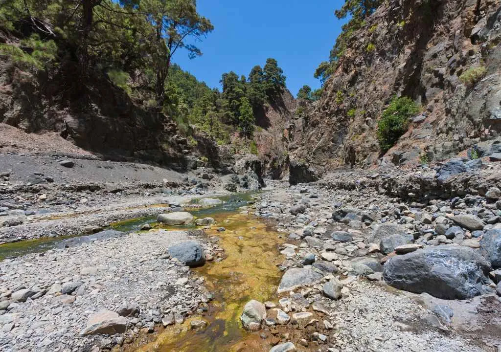
- Walk through the Barranco de las Angustias. A spectacular ravine surrounded by cliffs and unique rock formations that showcase the geological power of La Palma.
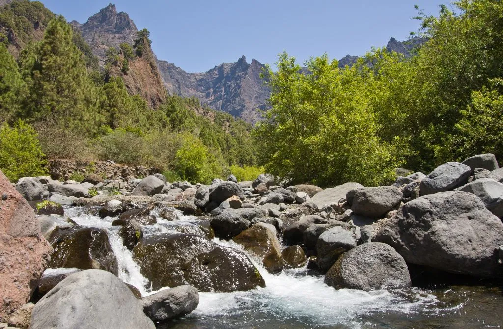
Swim in the Taburiente River
After a few hours of hiking, few things feel better than a refreshing dip in the Taburiente River.
Here, in the heart of the park, lies the Playa de Taburiente, a natural bathing area where cold, crystal-clear waters flow between smooth stones and native plants.
This tranquil corner can be reached after about two hours’ walk from Los Brecitos, through dense Canary pine forest.
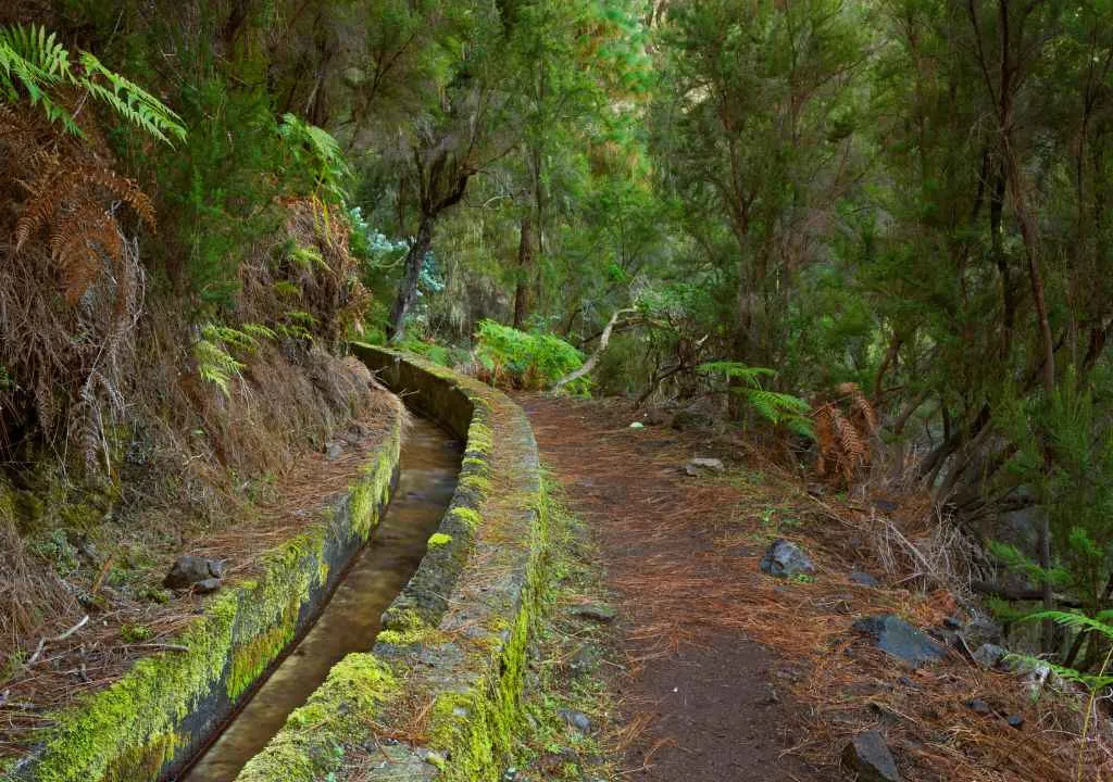
The river symbolizes the Caldera’s rich hydrology, fed by more than 70 springs and water galleries, which are vital both for its ecosystems and for the island’s agricultural history.
Stay Overnight at the Campsite
If you want to fully connect with nature, the Caldera de Taburiente campsite allows you to spend the night inside the National Park, surrounded by pine forest and mountain silence.
Located near Playa de Taburiente, it offers basic facilities, supervision, and tent areas.
Reservations are required in advance through the official National Park website.
The Famous “Cascada de los Colores”
One of the most iconic spots in the park is the Cascada de los Colores: a vibrant, almost surreal waterfall that looks like a natural painting.
Though not entirely natural, it’s a fascinating sight created when a small wall built in the 1960s to channel water began to oxidize. Over time, minerals (especially iron) stained the rock with brilliant hues of yellow, orange, and red.
Add the ever-present humidity, bright green moss, and black volcanic earth, and you have one of La Palma’s most photogenic places.
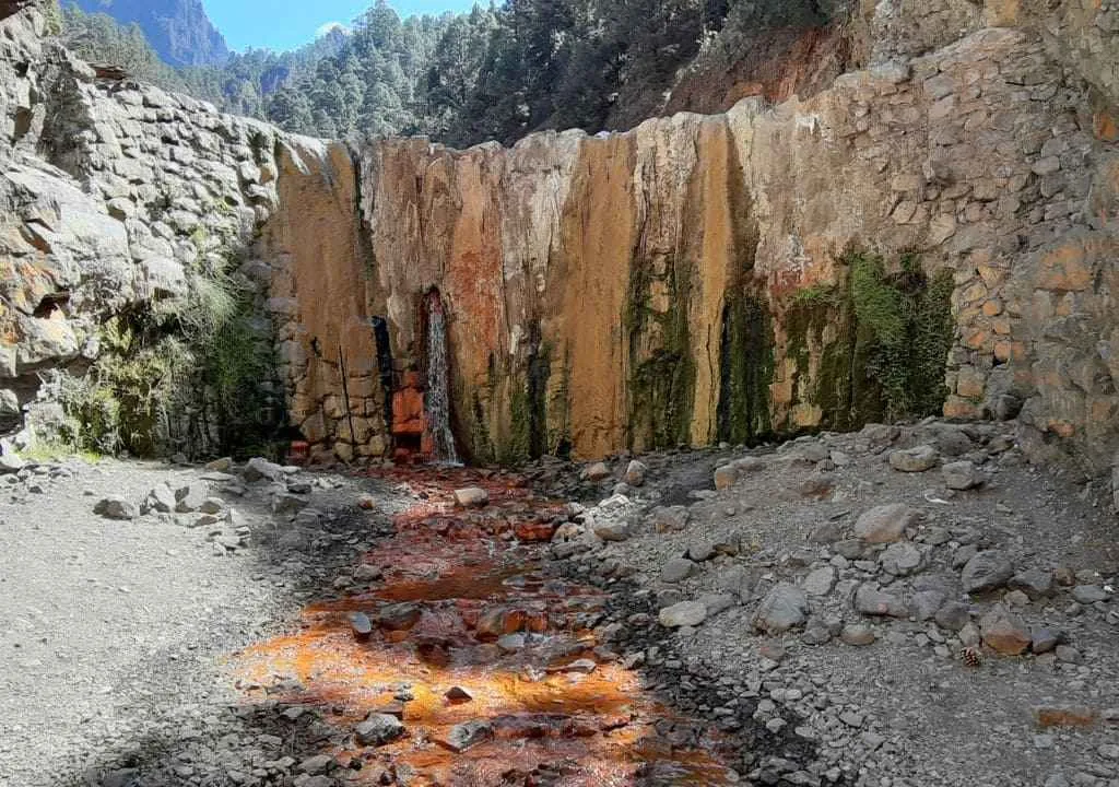
Where Is the Cascada de los Colores and How to Get There
The waterfall lies near Dos Aguas, where the main streams of the park converge and form the Barranco de las Angustias.
You can reach it in two main ways:
- From Los Brecitos (long route), included in the official trail through the park. After passing Playa de Taburiente, follow the descent to Dos Aguas and take the marked detour to the waterfall. This is the recommended option if you plan to hike the full route.
- From the Barranco de las Angustias (short route), for those who only wish to see the waterfall. This circular route is about 13 km round trip, starting from the La Viña parking area and following the riverbed. It’s a demanding walk with little shade and uneven terrain, taking around 1.5 hours to reach the waterfall and a bit longer to return.
Main Trail Technical Data
| Route Name | Los Brecitos – Playa de Taburiente – Barranco de las Angustias |
|---|---|
| Total distance | 16.3 km |
| Approximate duration | 5–6 hours |
| Elevation change | ↑ 258 m / ↓ 1,111 m |
| Type of route | Linear (mostly downhill) |
| Difficulty level | Moderate |
| Starting point | Mirador de Los Brecitos (accessible only by taxi) |
| End point | Parking area at Barranco de las Angustias (La Viña) |
Practical Tips
- Los Brecitos is only accessible by taxi from the La Viña parking area. Make sure to book transport before you arrive.
- Wear sturdy hiking boots: some sections are rocky or slippery.
- Bring enough water and food: there are no cafés or shops inside the park.
- Check trail conditions before hiking; some routes close temporarily during heavy rains.
- Sun protection is essential: wear a hat, sunscreen, and lightweight technical clothing.
- Carry a map or GPS and keep your phone fully charged for safety.
- Start before midday to make the most of daylight and avoid the afternoon heat.
- Help preserve the park: do not pick plants, feed animals, or leave any litter.
- Arrive early at the parking area to easily share a taxi with other hikers and save money.
Curiosities and Interesting Facts
- The Caldera de Taburiente was declared a National Park in 1954, one of the first in Spain.
- Its caldera-shaped formation is the result of a massive landslide followed by millions of years of erosion, it’s the largest erosive depression in Europe.
- It has been part of the UNESCO La Palma Biosphere Reserve since 2002.
- In 2022, it was included among the 100 most important geological sites in the world by the IUGS.
- The Caldera is one of La Palma’s best stargazing locations, protected from light pollution.
- In 2020, researchers discovered that around 200,000 years ago, a vast lake once existed inside the Caldera, a groundbreaking find led by José Heriberto Lorenzo Pérez, an environmental officer of the park.
Unique Flora and Fauna
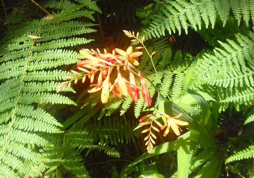
The Caldera de Taburiente is a true sanctuary of biodiversity in La Palma. Its ravines, slopes, and summits host an astonishing variety of native plant species, including many endemics found only in the Canary Islands.
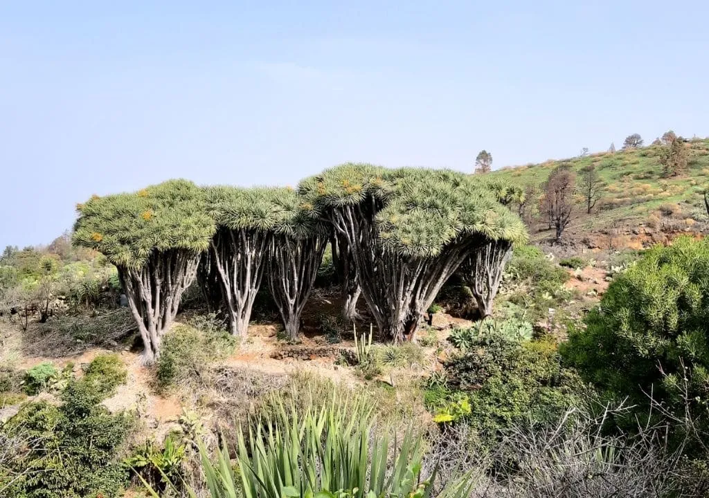
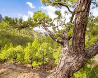
Among the most characteristic plants are the codeso, retamón, and the majestic Canary pine, a symbol of volcanic ecosystems across the archipelago. This conifer can live up to 500 years and is famous for its ability to regenerate after wildfires, withstand drought, and thrive in poor volcanic soils.
The park’s fauna is just as diverse. On the ground, you may spot centipedes, lizards, and frogs, while the skies above are alive with kestrels, ravens, wild canaries, blue tits, and the striking red-billed chough.
In quieter corners, bats and rabbits inhabit the pine forest, completing an ecosystem of remarkable ecological value.
YOUR EXPERIENCE SHINES HERE
If you’ve visited this place, share your impressions and leave a small trace of your journey. Help other travelers discover the true beauty of La Palma.
*Your review is completely anonymous
How to Get There
Visiting the Caldera de Taburiente National Park is easy, whether you come by car or prefer a guided excursion.
By car + taxi:
From Santa Cruz de La Palma or Los Llanos de Aridane, drive along the LP-3 road to El Paso.
If you want to start from La Cumbrecita, park there (advance reservation required).
To begin from Los Brecitos – the classic route – park at La Viña and take a taxi that will drop you at the trailhead.
Guided excursion with transfer:
Several local agencies organize full-day hiking tours that include:
- Pick-up from your accommodation
- Transport to the starting point (Los Brecitos)
- Professional guide throughout the route
- Return transfer after the hike
- This is the most comfortable and safest way to enjoy the experience without worrying about logistics or transport.
Explore de Caldera de Taburiente with a guide
Discover Europe’s Largest Volcanic Crater: Epic Group Trekking Tour Inside La Palma’s Heart, the Majestic Caldera de Taburiente!
Caldera de Taburiente map