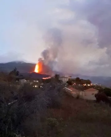
Tajogaite, whose name in the ancient Benahoarite language means “split mountain”, is the volcano that emerged in 2021 after the historic Cumbre Vieja eruption. From the first explosions on September 19 until it ended on December 13, its activity shaped both the landscape and the lives of the island’s people.
A volcano that transformed the landscape and life on La Palma
The eruption of Tajogaite left a profound mark on the island, not only on its terrain but also on the daily lives of its inhabitants. Here is a summary of its most significant human and geographical impacts:
- Destroyed neighborhoods: Todoque disappeared completely under the lava, becoming one of the symbols of the tragedy. Other areas were partially lost, such as La Laguna, Los Campitos, El Paraíso, and Los Guirres beach.
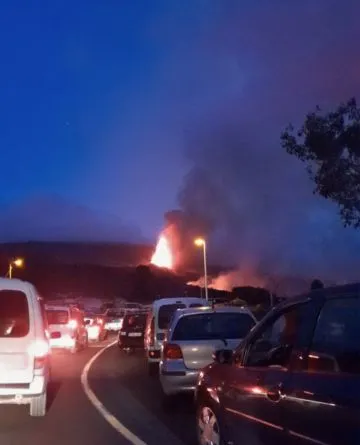
- Mass evacuations: More than 7,000 people were urgently evacuated during the first days of the eruption.
- Homes destroyed: Over 1,300 houses were destroyed, many of them primary residences.
- Infrastructure damage: More than 73 km of roads were damaged, along with water, electricity, and communication networks.
- Volcanic ash: The ash emission was so intense that it reached neighboring islands like Tenerife, El Hierro, La Gomera, and Gran Canaria.
- Airport closure: La Palma’s airport was inoperable for 10 days due to ash accumulation, making travel even more difficult.
- Psychological and economic impact: Many families lost everything, including their homes and livelihoods, especially in agriculture, tourism, and small businesses.
Technical data on the Tajogaite volcano
A closer look at the key figures and geological features of the volcano that defined La Palma’s recent history:
- Eruption start: Sunday, September 19, 2021, at 3:13 PM (local time) in Cabeza de Vaca, El Paso municipality.
- Eruption end: Monday, December 13, 2021, after 85 days and 8 hours of uninterrupted activity.
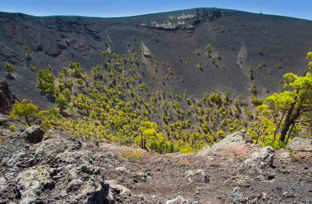
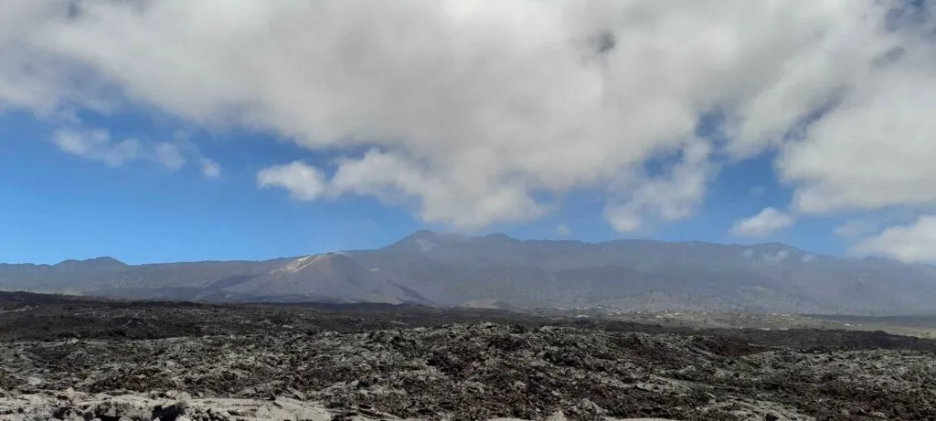
- Current altitude: The new volcanic cone reaches 1,120 meters above sea level.
- Structure: Formed by six craters aligned along a fissure on the Cumbre Vieja ridge, in an area known as Cabeza de Vaca (El Paso).
- Type of eruption: Strombolian, with fluid lava flows, explosions, ash, and volcanic gases.
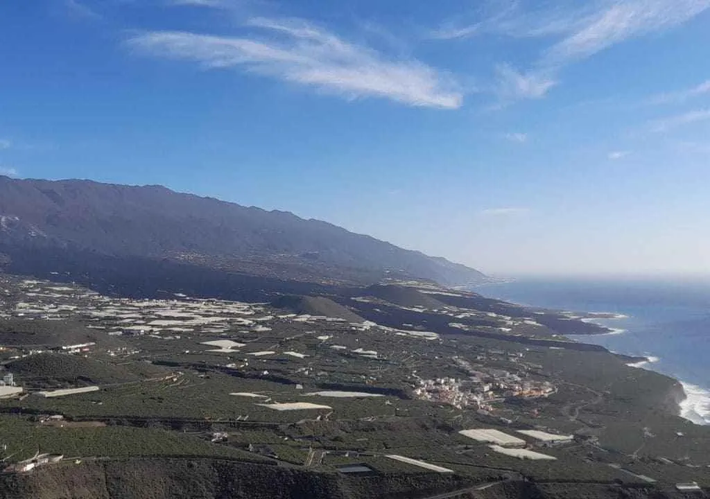
- Affected municipalities: Primarily El Paso, Los Llanos de Aridane, and Tazacorte, on the island’s western side.
- Affected land: Lava covered more than 1,219 hectares, destroying homes, farmland, roads, and basic infrastructure.
Detailed timeline of the Tajogaite eruption
| Date | Main event |
|---|---|
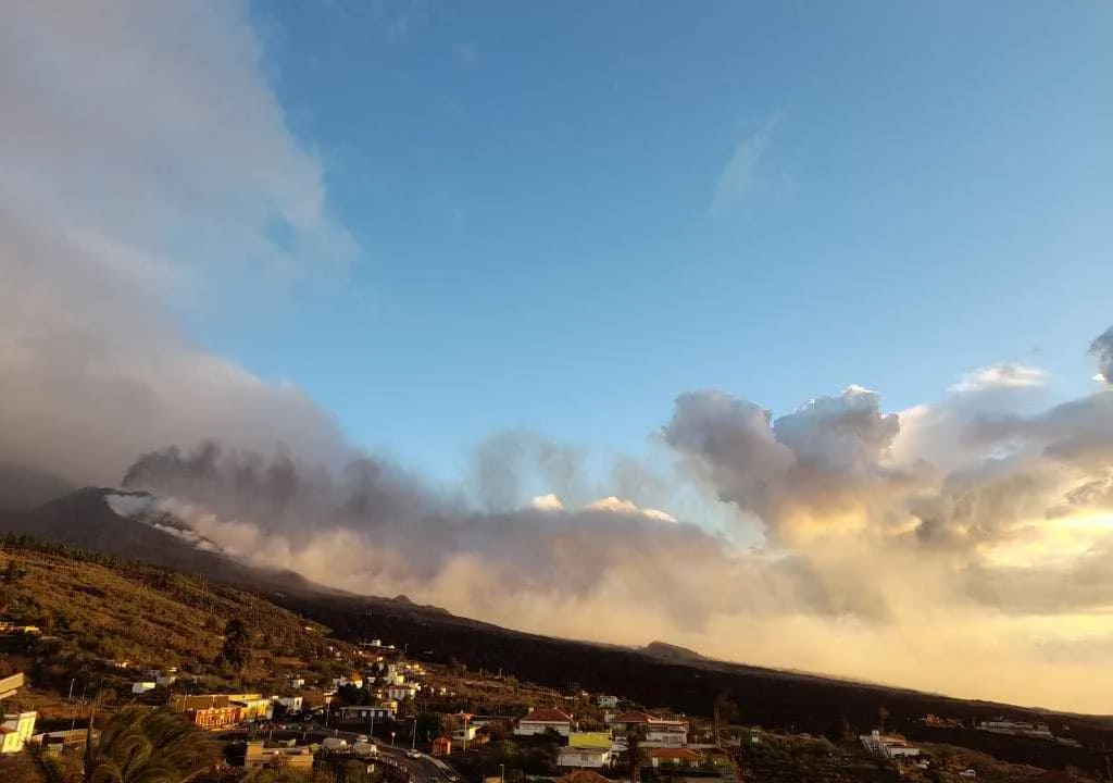
| September 19 | Eruption begins in Cabeza de Vaca, El Paso, with two fissures and eight vents. |
| September 20 | Three lava flows up to six meters high form. Over 5,000 people evacuated. |
| September 21 | Lava reaches Todoque, a neighborhood of 1,200 residents. |
| September 22 | Volcano enters explosive phase, with heavy ash emission. |
| September 24 | Two new vents open. Tajuya and parts of Tacande evacuated. Flights suspended. |
| September 25 | Partial collapse of the main cone and new vent produces more fluid lava flow. |
| September 27 | Hotter, less viscous lava flows faster and increases destruction. |
| September 28 | Lava reaches the sea at Playa del Perdido, Tazacorte. |
| October 20 | Northern lava flow crosses La Laguna. Magnitude 4.8 earthquake. |
| October 23 | Partial collapse of main cone, lava overflows. 30 earthquakes recorded. |
| October 30 | First earthquakes above magnitude 5. |
| November 3 | Tremor and sulfur dioxide decrease, indicating positive evolution. |
| November 10 | New flow reaches sea at Los Guirres beach. |
| November 12 | One person dies in El Paso from eruption-related causes. |
| November 19 | Magnitude 5.1 earthquake, strongest of the eruption. |
| November 22 | Lava reaches sea for fourth time. 3,000 confined in Tazacorte. |
| November 25 | New vent south of main cone produces more fluid lava. |
| November 28–30 | New vent opens; main cone pauses while secondary cone remains active. |
| December 12 | Longest eruption recorded. Tremor disappears, minor quakes continue. |
| December 25 | Eruption officially declared over (ended December 13) after 85 days, 8 hours. |
What to see near the volcano today
Despite the magnitude of the eruption, most of La Palma remains as impressive as ever. Only a small percentage of its territory was affected, meaning the island’s natural and cultural wonders remain intact and ready to discover. Today, it is possible to approach and safely admire the new volcanic landscapes created by Tajogaite.
Here are some of the most exciting experiences you can have:
Guided hike to Tajogaite
The only safe way to get close to the crater area. The guided route departs from El Paso or your accommodation and takes you along a controlled path to the north crater rim. An unforgettable experience that lets you witness the raw power of nature and the new lava-formed landscapes.
Tacande and Tajuya viewpoints
Tacande and Tajuya are two easily accessible viewpoints offer excellent panoramas of the Tajogaite cone and the lava flows. Both are reachable by car and ideal for photography without long hikes.
Mirador del Time and Puerto de Tazacorte
From these spots, you can see the new fajanas (lava deltas) created when lava reached the sea. The views are spectacular, especially at sunset. You can also take a boat tour to admire the newly formed coastline from the water.
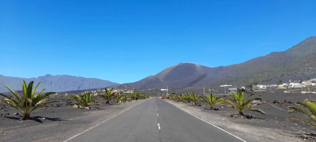
The new coastal road
Inaugurated at the end of 2023, this road connects La Laguna and Las Manchas through the lava-razed area. Built in just 14 months, it is the world’s first road with a heat-resistant layer that can withstand temperatures up to 300 °C, a feat of engineering that symbolizes the island’s resilience.
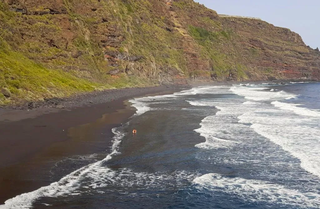
Lava deltas (Fajanas) of Tajogaite
The Tajogaite eruption not only destroyed neighborhoods and farmland, but also created striking new forms, the massive fajanas, or lava deltas, formed where lava met the sea.
What is a lava delta?
A fajana is a coastal platform created when lava flows into the ocean and solidifies on contact with water, effectively “reclaiming” land from the sea. In La Palma, these deltas have completely reshaped the western coastline.
Where can you see them?
- Mirador del Time
- Puerto de Tazacorte
- Mirador de las Hoyas, on the road down to Puerto Naos
- The new coastal road, which crosses the delta between La Laguna and Las Norias
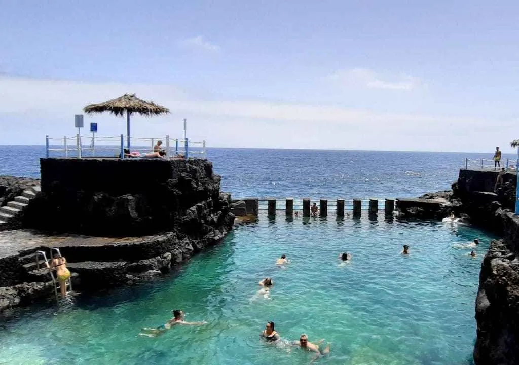
Another example is the Fajana de Barlovento, on La Palma’s northeast coast, where solidified lava was used to create natural pools in a stunning volcanic setting.
YOUR EXPERIENCE SHINES HERE
If you’ve visited this place, share your impressions and leave a small trace of your journey. Help other travelers discover the true beauty of La Palma.
*Your review is completely anonymous
Puerto Naos and La Bombilla: a slow and partial return
Although the eruption ended in December 2021, it wasn’t until early 2024 that the first residents of Puerto Naos and La Bombilla were allowed to return to their homes. For over two years, these areas remained closed due to high concentrations of toxic gases, especially carbon dioxide, trapped in buildings and enclosed spaces, a serious health risk.
Even today, access remains limited in some parts. Many homes, businesses, and services are still closed, and entry restrictions persist in areas where gas levels are not yet fully safe. Despite constant monitoring and gradual reopening plans, everyday life in these tourist hubs on La Palma’s west coast is still far from normal.
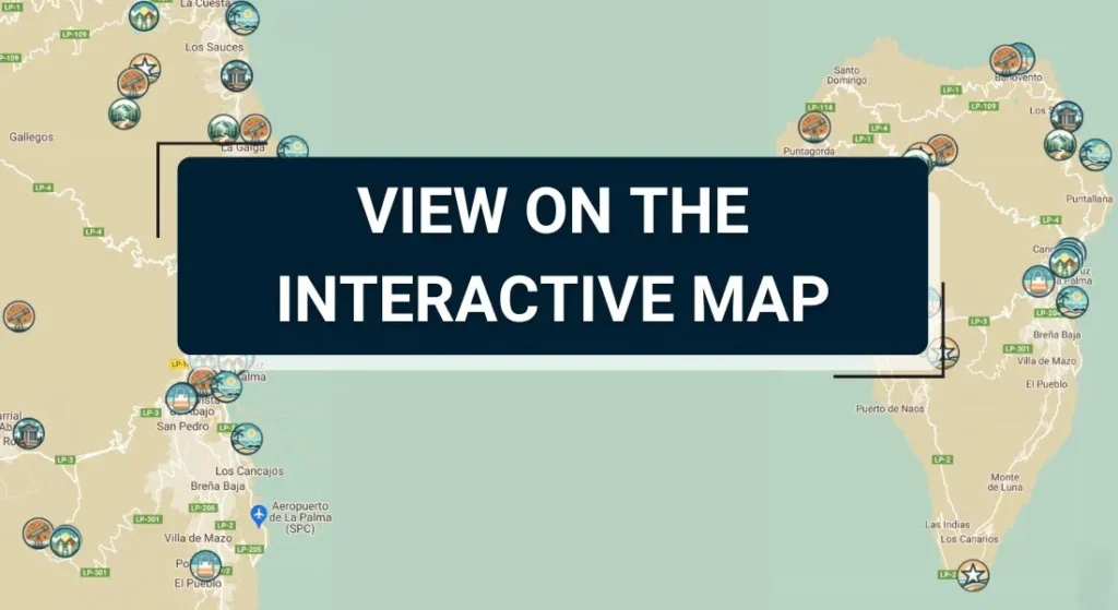
Tajogaite volcano map